 SAN
FRANCISCO
SAN
FRANCISCO
SAN
FRANCISCO
SAN
FRANCISCO
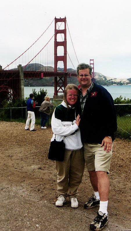 Debbie and I visited San Francisco in the summer of
2000. It was a
surprise
for Debbie. I wouldn't tell her where we were going. Somehow I managed
to keep our destination a secret from her until the time we actually
boarded
the plane. On June 28, we flew on United Airlines onboard a Boeing 757.
It took around 7 hours over some pretty incredible scenery (Debbie
slept
the whole way).
Debbie and I visited San Francisco in the summer of
2000. It was a
surprise
for Debbie. I wouldn't tell her where we were going. Somehow I managed
to keep our destination a secret from her until the time we actually
boarded
the plane. On June 28, we flew on United Airlines onboard a Boeing 757.
It took around 7 hours over some pretty incredible scenery (Debbie
slept
the whole way).
We had a great time, though it doesn't get very warm there. The highest temp was 72 degrees. There was fog and a lot of wind (not all from me talking either.) This was the place that Mark Twain said that the coldest winter he ever experienced was a summer in San Francisco. Having been here, I kind of know what he was talking about.
Then there are the hills. You hear about them and you see pictures, but you never really grasp the scope until you start walking around the city. Some of the streets are so steep, I can't see how people walk up and down them every day of their lives.
We stayed in a Holiday Inn on Van Ness Avenue between the Pacific Heights section and Nob Hill. We were one block from the California Street cable car stop. We bought a week long pass for the cable cars to avoid those hills. This is an ideal way to get around San Francisco. They have passes called Muni Passports (short for San Francisco Municipal Railroad) that you can use to ride the cable cars along with the streetcars and buses. The passes can be bought for one, three or seven days. We bought seven day Passports for $15.00 each (it is a major bargain when you consider that a one-way trip on a cable car costs $2.00 - in 2000). You can only buy them in certain places. We bought ours at the Visitor Information Center (on the lower level of Hallidie Plaza on the corner of Market and Powell Streets). You can also buy them at City Hall information kiosk, the Powell-Hyde cable car turntable, the airport along with a few stores around San Francisco.
They also have a San Francisco
CityPass that you
can buy for $36.00 (that was the price in 2000). It includes the
seven-day pass on the cable cars,
streetcars
and buses along with free passes to the Steinhart
Aquarium & California Academy of Sciences in Golden Gate Park,
California
Palace of the Legion of Honor art museum (they have a Monet
"Waterlilies")
also in Golden Gate Park, Exploratorium
science museum next to the Palace of the Fine Arts near the Presideo
&
San
Francisco Museum of Modern Art in the Financial District along with
a Blue & Gold Fleet Bay Cruise. It would cost you $38.50 just for
admission
to the four museums alone. The bay cruise alone is $20.00 (again that
was in 2000). So if you
bought
a CityPass you would almost break even with the seven-day pass and the
bay cruise making any museum visit free. If you plan to visit even two
museums, this pass is worth it.
|
A
Brief History of San Francisco
 Despite all of the exploring of the "New World" by the
English, Spanish and Portuguese, San Francisco Bay was missed for a
hundred years. It was not entered by a European explorer until
1769 when Don Gaspar de Portloa leads a party overland and discovers
the bay. In 1775, the first ship, the San
Carlos of Spain, enters the bay. The Spanish built a fort (presideo)
here in 1776. Later
that year, Father Junípero Serra established nearby the
Misión San Francisco de Asís (now called Mission
Dolores - photo at right). There was very little settlement in the
area. In 1821, when Mexico declared its independence from Spain, it
became Mexican territory. In 1835, William Richardson founds the
village of Yerba Buena (named for a local plant) which was later
re-named San Francisco in 1847. The village has about 800 inhabitants
with 200 buildings.
Despite all of the exploring of the "New World" by the
English, Spanish and Portuguese, San Francisco Bay was missed for a
hundred years. It was not entered by a European explorer until
1769 when Don Gaspar de Portloa leads a party overland and discovers
the bay. In 1775, the first ship, the San
Carlos of Spain, enters the bay. The Spanish built a fort (presideo)
here in 1776. Later
that year, Father Junípero Serra established nearby the
Misión San Francisco de Asís (now called Mission
Dolores - photo at right). There was very little settlement in the
area. In 1821, when Mexico declared its independence from Spain, it
became Mexican territory. In 1835, William Richardson founds the
village of Yerba Buena (named for a local plant) which was later
re-named San Francisco in 1847. The village has about 800 inhabitants
with 200 buildings.The United States took possession of San Francisco after the Mexican War in 1846. This was about the same time as gold was discovered in California turning San Francisco into a booming community. It became a city in 1850 and was known for it's lawless areas, like the Barbary Coast and for it's rich mansions on Nob Hill. Montgomery Street becomes the main business district which it still is today. California becomes a state the same year. In 1862, the telegraph links New York with San Francisco. The transcontinental railroad linked San Francisco with the East Coast in 1869, making a fortune for the a group of tycoons known as the "Big Four". In 1873, the first cable cars are tested and Levi Strauss patents his process for making riveted jeans. As the 20th Century dawns, new buildings and hotels are being built all over the city. Mayor Abe "Boss" Ruef becomes the powerbroker of San Francisco (he will plead guilty to extortion in 1907). 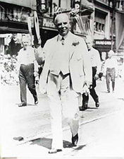 All of the growth and development will come to an abrupt halt, if only
temporary. On the morning of April 18, 1906, an earthquake shook the
city. Flames from burst gas mains erupted and
caused a fire that
raged for three days, destroying almost all of San Francisco's downtown
and much of the residential area (more on that below). However, the
city was quickly
rebuilt, and in 1915 it played host to the Panama-Pacific International
Exposition. In 1911, "Sunny Jim" Rolph (photo at left) is elected mayor
and serves until 1930 (when he resigns to be governor).
All of the growth and development will come to an abrupt halt, if only
temporary. On the morning of April 18, 1906, an earthquake shook the
city. Flames from burst gas mains erupted and
caused a fire that
raged for three days, destroying almost all of San Francisco's downtown
and much of the residential area (more on that below). However, the
city was quickly
rebuilt, and in 1915 it played host to the Panama-Pacific International
Exposition. In 1911, "Sunny Jim" Rolph (photo at left) is elected mayor
and serves until 1930 (when he resigns to be governor).In 1936, the Bay Bridge opens and Pan American Clippers arrive in the city taking people to Asia. The Golden Gate Bridge opened the following year. After the attack on Pearl Harbor in 1941, Japanesse-American internment begins. During the Second World War, San Francisco became a major shipbuilding area. When the war is over, the UN Peace Conference is held in San Francisco which leads to the founding of the United Nations.  In 1946, the San Francisco 49ers became the first major league
professional sports franchise on the West Coast. In 1958, The New York
Giants relocated to San Francisco giving them their first baseball
franchise. They have won three pennants here, but have not won a World
Series since 1905. In 1961, the San Francisco Seals hockey team started
in the
Western Hockey League and six years later, after they moved across the
bay, they joined
the N.H.L. They were re-named the California Golden Seals (logo at
left), but never
did well and eventually moved to Cleveland in 1976 becoming the
Cleveland Barons
In 1946, the San Francisco 49ers became the first major league
professional sports franchise on the West Coast. In 1958, The New York
Giants relocated to San Francisco giving them their first baseball
franchise. They have won three pennants here, but have not won a World
Series since 1905. In 1961, the San Francisco Seals hockey team started
in the
Western Hockey League and six years later, after they moved across the
bay, they joined
the N.H.L. They were re-named the California Golden Seals (logo at
left), but never
did well and eventually moved to Cleveland in 1976 becoming the
Cleveland Barons  (After two more years of losses, the Barons
were permitted to merge with the financially struggling Minnesota North
Stars who later moved to Dallas). In 1991, The San
Jose Sharks (logo at right) NHL team brought professional hockey back
to the San
Francisco Bay area. They have won three divisional titles but have yet
to raise the Stanley Cup. In 1962, the Philadelphia Warriors basketball
team
re-located to San Francisco. They have since moved across the bay and
are called the Golden State Warriors. In 1968, the Kansas City
Athletics (formally the Philadelphia Athletics) moved to Oakland. Since
then, the A's have won six pennants and four World Series including
1989, the only one between Oakland and San Francisco. (After two more years of losses, the Barons
were permitted to merge with the financially struggling Minnesota North
Stars who later moved to Dallas). In 1991, The San
Jose Sharks (logo at right) NHL team brought professional hockey back
to the San
Francisco Bay area. They have won three divisional titles but have yet
to raise the Stanley Cup. In 1962, the Philadelphia Warriors basketball
team
re-located to San Francisco. They have since moved across the bay and
are called the Golden State Warriors. In 1968, the Kansas City
Athletics (formally the Philadelphia Athletics) moved to Oakland. Since
then, the A's have won six pennants and four World Series including
1989, the only one between Oakland and San Francisco.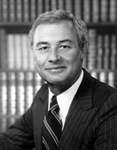 In
the late 1950's, the literary development of the Beat Generation, with
writers Jack Kerouac, Allen Ginsberg and Neal Cassidy, was
centered in San Francisco's North Beach area. In 1967, 25,000 hippies
and others attend a day of music in Golden gate Park. The Monterey Pop
Festival
will feature Jimi Hendricks, Otis Redding and The Who. Local blues and
soul singer Janis Joplin will become famous.
In
the late 1950's, the literary development of the Beat Generation, with
writers Jack Kerouac, Allen Ginsberg and Neal Cassidy, was
centered in San Francisco's North Beach area. In 1967, 25,000 hippies
and others attend a day of music in Golden gate Park. The Monterey Pop
Festival
will feature Jimi Hendricks, Otis Redding and The Who. Local blues and
soul singer Janis Joplin will become famous.  In
1973, the Transamerica Pyramid will be completed. The following year,
Patty Hearst, of the famous Hearst family will be kidnapped and later
join her kidnappers. In 1978, Mayor George Moscone (photo at right),
along with gay politician Harvey Milk, will be assassinated in city
hall by a former policeman. In 1981, the San Francisco 49ers, led by
Joe Montana (photo at left) will win their first of five Super Bowl
titles, tied for the most, and have the distinction of being the only
team to never lose a Super Bowl. In 1989, during a World
Series game, another earthquake, called the Loma Prieta earthquake,
struck the city causing death and
destruction, though nowhere near as bad as 1906.
In
1973, the Transamerica Pyramid will be completed. The following year,
Patty Hearst, of the famous Hearst family will be kidnapped and later
join her kidnappers. In 1978, Mayor George Moscone (photo at right),
along with gay politician Harvey Milk, will be assassinated in city
hall by a former policeman. In 1981, the San Francisco 49ers, led by
Joe Montana (photo at left) will win their first of five Super Bowl
titles, tied for the most, and have the distinction of being the only
team to never lose a Super Bowl. In 1989, during a World
Series game, another earthquake, called the Loma Prieta earthquake,
struck the city causing death and
destruction, though nowhere near as bad as 1906.Today San Francisco is the fourth most populous city in California and the 14th most populous city in the United States, with a 2007 estimated population of 764,976. One of the most densely populated major American cities, San Francisco is the core of the San Francisco metropolitan area, home to 4.2 million people, which itself is part of the much larger San Francisco Bay Area containing 7.2 million people. San Francisco is characterized by a high standard of living. The great wealth and opportunity generated by the Internet revolution drew many highly educated and high income workers and residents to San Francisco. The city is also known for its diverse, cosmopolitan population, including large and long-established Asian American and its Gay communities. It also has a large homeless population. |
 After checking in at the hotel, the first place we
visited was Fisherman's Wharf.
This is where you
will
find most of the tourists that visit San Francisco. It roughly
encompasses the northern waterfront area of San Francisco from
Ghirardelli Square or Van Ness Street east to Pier 35 or Kearny Street.
Some of the restaurants, like Pompeii's and Alioto's #8, go back for
three generations of the same family ownership. Nearby Pier 45, there
is a chapel in memory of the "Lost Fishermen" of San Francisco and
Northern California.
After checking in at the hotel, the first place we
visited was Fisherman's Wharf.
This is where you
will
find most of the tourists that visit San Francisco. It roughly
encompasses the northern waterfront area of San Francisco from
Ghirardelli Square or Van Ness Street east to Pier 35 or Kearny Street.
Some of the restaurants, like Pompeii's and Alioto's #8, go back for
three generations of the same family ownership. Nearby Pier 45, there
is a chapel in memory of the "Lost Fishermen" of San Francisco and
Northern California.
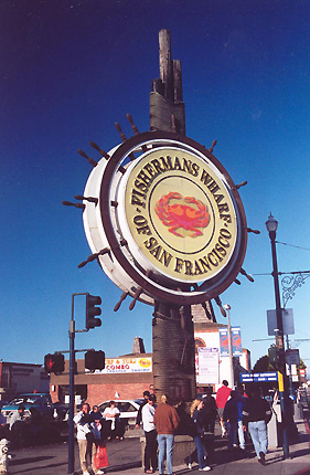
That tourist on the corner
next to the traffic light sure looks familar. Where have we seen her
before? Much of this fame of Fisherman's Wharf is due to the annual
harvest of the very
popular and desired of all crustaceans, the Dungeness crab (you can see
one in the center of the sign). All throughout the wharf you can buy
them to be eaten there or taken home. The Dungeness crab is a species
of crab that inhabits eelgrass beds and water bottoms from the Aleutian
Islands in Alaska to Santa Cruz, California. About one quarter of this
crab's weight is meat, making it one of the meatiest crabs available.
Most of the meat is in the eight legs and two claws, although the body
contains plenty as well. They are named after the town of Dungeness in
northwestern Washington state.
After walking here
from our hotel we had lunch in a restaurant on the waterfront. Some of
the restaurants, like Pompeii's and Alioto's #8, go back for
three generations of the same family ownership. The restaurants and
stands serve fresh seafood, most notably dungeness crab and clam
chowder
served in a sourdough bread bowl. One of
the
things
I enjoyed here was the clam chowder served in a sourdough bowl. The
Boudin
Sourdough Bakery is here and almost always crowded.
The Boudin
Family has been baking bread since 1849 when they discovered something
unique. Wild yeast in the San
Francisco air had imparted a unique tang to their traditional French
bread, giving rise to “San Francisco sourdough French bread.” The
family survived the 1906 earthquake and in 1975 moved their bakery to
Fisherman's Wharf. Since we were there, they have opened a bakery
museum and tour.
Also here is San Francisco
Maritime National Historical Park, the Cannery Shopping Center,
Ghirardelli Square, a Ripley's Believe it or
Not museum, the Rain Forest cafe, the Musée
Mécanique and the Wax Museum at
Fisherman's Wharf. We visited The wax museum. It is all right, but it's
no Madame Tussauds.
Another very
popular
tourist attraction is Pier 39
which
contain a number of restaurants and shops on a pier that juts out into
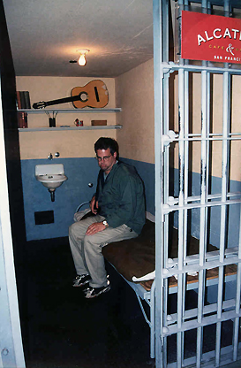
the bay. One of the restaurants is called "Alcatraz bar and grill" and
has a mock up of one of the cells on the island prison (there is a
picture of me in it below). Fisherman Wharf
is also where Blue &
Gold boat tours leave from. Pier 39 has another interesting
attraction - sea lions. California Sea Lions have been hanging out on
the pier since the 1990s. Each winter, the population can
increase up to 900 sea lions, most of
which are male. During the summer months, the sea lions migrate south
to the Channel Islands for breeding season.
Also here is the
Liberty Ship S.S. Jeremiah O'Brien.
A participant in the D-day landing in Normandy during World War II,
this Liberty Ship freighter is one of two such vessels (out of 2,500
built) still in working order. To keep the 1943 ship in sailing shape,
the steam engine -- which appears in the film Titanic - is operated dockside
seven times a year on special "steaming weekends." Cruises take place
several times a year between May and October.
 Fisherman’s Wharf,
which has been the home of San Francisco’s colorful fishing fleet (at
right) for
nearly a century and a quarter, is world famous for its wide variety of
ocean fish and of course, the much desired Dungeness crab. [NOTE: if
you look at the picture you can see a large bird on the bow of the boat
at left taking off]
Fisherman’s Wharf,
which has been the home of San Francisco’s colorful fishing fleet (at
right) for
nearly a century and a quarter, is world famous for its wide variety of
ocean fish and of course, the much desired Dungeness crab. [NOTE: if
you look at the picture you can see a large bird on the bow of the boat
at left taking off] San Francisco Bay is a shallow, productive estuary through which water
draining from approximately forty percent of California, flowing in the
Sacramento and San Joaquin rivers from the Sierra Nevada mountains,
enters the Pacific Ocean. The Bay covers somewhere between 400 and
1,600 square miles, depending on which sub-bays (such as San Pablo
Bay), estuaries, wetlands, and so on are included in the measurement.
The main part of the Bay measures 3 to 12 miles wide east-to-west and
somewhere between 48 miles to 60 miles north-to-south.
San Francisco Bay is a shallow, productive estuary through which water
draining from approximately forty percent of California, flowing in the
Sacramento and San Joaquin rivers from the Sierra Nevada mountains,
enters the Pacific Ocean. The Bay covers somewhere between 400 and
1,600 square miles, depending on which sub-bays (such as San Pablo
Bay), estuaries, wetlands, and so on are included in the measurement.
The main part of the Bay measures 3 to 12 miles wide east-to-west and
somewhere between 48 miles to 60 miles north-to-south.  That
afternoon, we walked down to Ghirardelli
Square (pronounced 'Gear-ar-delly'). They are the famous makers of
chocolate, so you can guess
who
was very happy to visit. The picture here is of us in the middle of the
square next to the fountain.
That
afternoon, we walked down to Ghirardelli
Square (pronounced 'Gear-ar-delly'). They are the famous makers of
chocolate, so you can guess
who
was very happy to visit. The picture here is of us in the middle of the
square next to the fountain.
In 1817, Domenico Ghirardelli was
born in Rapallo, Italy (near Genoa) to an exotic foods importer. At a
young age, Domenico was introduced to the chocolate and confectionery
trade when he apprenticed for a local candy maker. He immigrated to
Peru in 1838 and later to San Francisco during the Gold Rush of 1849 to
make his fortune panning for gold. Not finding gold, he opened a
general store in Stockton, California, offering supplies and
confections to fellow miners. 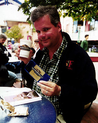 In 1852, he moved to San Francisco and
established the Ghirardelli Chocolate Company. There would be several
locations before finally settling at what would become Ghirardelli
Square in 1895. The stores survived the 1906 Earthquake and fire. The
famous clock tower (below left) was built in 1911. Ghirardelli Square
was granted
National Historic Register status in 1982.
In 1852, he moved to San Francisco and
established the Ghirardelli Chocolate Company. There would be several
locations before finally settling at what would become Ghirardelli
Square in 1895. The stores survived the 1906 Earthquake and fire. The
famous clock tower (below left) was built in 1911. Ghirardelli Square
was granted
National Historic Register status in 1982.
 Around
the year 1865,
Ghirardelli discovered that by hanging a bag of ground cacao beans in a
warm room, the cocoa butter would drip off, leaving behind a residue
that can then be converted into ground chocolate. This technique, known
as the Broma process is now the most common method for the production
of chocolate.
Around
the year 1865,
Ghirardelli discovered that by hanging a bag of ground cacao beans in a
warm room, the cocoa butter would drip off, leaving behind a residue
that can then be converted into ground chocolate. This technique, known
as the Broma process is now the most common method for the production
of chocolate.
Ghirardelli died in 1894, but his company continued to grow. In 1998, Lindt and Sprungli Chocolate of Switzerland acquires Ghirardelli Chocolate Company. Here I am enjoying some chocolate along with a hot chocolate.
Actually the square contains a
number of
restaurants
and shops in addition to the chocolate store. We came back later for
ice
cream. The ice cream store is very popular and you may have to wait in
line to get in. We did learn quickly, that it is tough
walking around San Francisco with all of the hills. Of course, it's a
good way to walk off all of that chocolate. All in all, a good
first day in San Francisco.
Thursday, June
30
was our first full day in San Francisco, and we spent it completely
exploring the city. We became experts riding the cable cars.
As we walked around the Financial
District, we watched people rushing to and from places,
knowing that
we
were in no hurry. What a great feeling. We
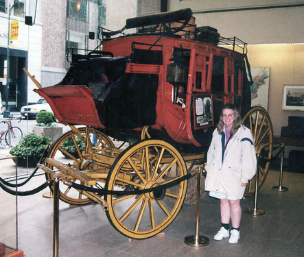
visited the Wells
Fargo Museum on Montgomery Street is on the site where
Wells Fargo first opened for business in 1852. What I found most
interesting was the old stage coaches. Believe me, you would not want
to
travel cross-country in one of those.
 Wells Fargo is a bank in California, but it
is also remembered in history as the company that ran stage coaches
across the western plains. Soon after gold was discovered in early 1848
at Sutter's Mill, financiers and entrepreneurs from all over North
America and the world flocked to California, drawn by the promise of
huge profits. Two easterners, Henry Wells of Vermont and William G.
Fargo of New York organized Wells, Fargo & Company in 1852 as
express and banking services to California. The company developed its
own stagecoach business, helped start and then took over the Overland
Mail Company, establishing twice-a-week mail service between St. Louis
and San Francisco, and participated in the Pony Express. Not to
mention, it also transported gold from California to the East.
Wells Fargo is a bank in California, but it
is also remembered in history as the company that ran stage coaches
across the western plains. Soon after gold was discovered in early 1848
at Sutter's Mill, financiers and entrepreneurs from all over North
America and the world flocked to California, drawn by the promise of
huge profits. Two easterners, Henry Wells of Vermont and William G.
Fargo of New York organized Wells, Fargo & Company in 1852 as
express and banking services to California. The company developed its
own stagecoach business, helped start and then took over the Overland
Mail Company, establishing twice-a-week mail service between St. Louis
and San Francisco, and participated in the Pony Express. Not to
mention, it also transported gold from California to the East.
The museum devotes
a lot of its exhibits to the stage coach. The Wells Fargo company used
what is called the 'Concord Stagecoach' which is what you see here in
the photo. They were built by the Abbot Downing Company in Concord, New
Hampshire. To make the ride smoother, they employed leather strap
braces under their stagecoaches which gave a swinging motion instead of
the jolting up and down of a spring suspension. The Concord
Stagecoaches were built so solidly that it became known that they
didn't break down but just wore out. They each weighed about 2,500
pounds and cost $1,100 to build, including the leather and damask cloth
interior. The Wells Fargo Company still owns ten original stagecoaches
(like the one seen here) which are displayed in their nine museums
around the Western United States and Alaska.
The Wells Fargo
stagecoach, pulled by a team of six horses, traveled an average five to
twelve miles an hour, changing horses at swing stations every 12 miles.
With as many as nine people seated on three benches inside. The
overland trip took about 25 days. A real danger for stagecoach
travelers was the risk of robbery by highwaymen or bandits. Cash
payrolls and bank transfers were regularly carried by these scheduled
stage lines, which operated without a telephone service to report
robberies. Charles Bolles aka "Black Bart" is known to have robbed
California stages from 1875 to 1883. He was famous for leaving poems at
the scenes of the crime. He accidentally left an embroidered
handkerchief after one hold-up that revealed his identity and
ended his career (he spent four years in in San Quentin Prison).
The Wells Fargo
stagecoach empire was short lived with the coming of the railroad. The
transcontinental railroad was completed in 1869, causing the stage
business to dwindle and Wells Fargo's stock to fall. However,
Wells Fargo Bank survived and is today the
5th largest bank in the United States by assets.
Transamerica Pyramid
and other San Francisco architecture
 |
 |
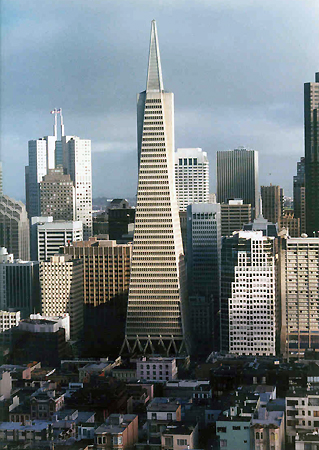
Built on
the location of the historic Montgomery Block, it has a height of
853
feet and contains 48 floors of retail
and office space. Construction began in 1969 and finished in 1972. The
building occupies the site that was the temporary home of A.P. Giannini's Bank of Italy after the
1906 San Francisco earthquake
destroyed its office. Giannini founded Transamerica in 1928 as a
holding company for his financial empire. His Bank of Italy later
became the Bank of America.
The Transamerica Pyramid is
currently ranked as the 98th tallest building in the world.
It was the tallest skyscraper west of the Mississippi from 1972-1974
(surpassing the nearby 555 California Street building formerly known as
the Bank of America Center), at which point it was surpassed by the Aon
Center in Los Angeles. Transamerica moved their headquarters to the new
building from across
the street, where they used to be based in another pyramid-shaped
building. It is now occupied by the Church of Scientology of San
Francisco.
Although it no longer houses the headquarters of the Transamerica Corporation, it is still strongly associated with the company and is depicted in the company's logo. The building is evocative of San Francisco and has become one of the many symbols of the city.
 The building is a tall, four-sided
pyramid with two "wings" on opposite sides of the building. It's design
was created to minimize the shadow the building would create. The wing
to the east of the building contains an elevator
shaft, while the wing to the west contains a stairwell and a
smoke tower. The building's façade is covered in crushed quartz,
giving the building its pure white color. The top of the Transamerica
Pyramid is covered with aluminum panels. Clearence between the panels
allows for lateral movement in case of an earthquake. During the
Christmas holiday
season, Thanksgiving and the Fourth of July, a bright, white light is
lit on top of the pyramid. Interestingly, only two of the building's 18
elevators reach the top floor.
The building is a tall, four-sided
pyramid with two "wings" on opposite sides of the building. It's design
was created to minimize the shadow the building would create. The wing
to the east of the building contains an elevator
shaft, while the wing to the west contains a stairwell and a
smoke tower. The building's façade is covered in crushed quartz,
giving the building its pure white color. The top of the Transamerica
Pyramid is covered with aluminum panels. Clearence between the panels
allows for lateral movement in case of an earthquake. During the
Christmas holiday
season, Thanksgiving and the Fourth of July, a bright, white light is
lit on top of the pyramid. Interestingly, only two of the building's 18
elevators reach the top floor.
 which is credited with creating
the salad
of the same name. The restaurant was closed during prohibition for
violations of the 18th amendment. It was called the Columbus Tower for
a number of years. With its copper-clad windows aged to a pastel green,
it is one of one of San Francisco's few "flatiron" buildings. Today,
Francis Ford Coppola houses his production studio, American
Zoetrope, in the building. Coppola, a famous epicure and owner of a
Napa winery, also owns the downstairs cafe (Cafe Niebaum-Coppola).
which is credited with creating
the salad
of the same name. The restaurant was closed during prohibition for
violations of the 18th amendment. It was called the Columbus Tower for
a number of years. With its copper-clad windows aged to a pastel green,
it is one of one of San Francisco's few "flatiron" buildings. Today,
Francis Ford Coppola houses his production studio, American
Zoetrope, in the building. Coppola, a famous epicure and owner of a
Napa winery, also owns the downstairs cafe (Cafe Niebaum-Coppola).
I took
another interesting contrast of past and present architecture (at
right). In the
foreground is the 285-ft. Hobart
Building on Market and Montgomery Streets in the financial district of San Francisco.
Completed in 1914, it took only 11 months to build and was at the time
the second tallest building in the city with 21 floors (its now around
113th tallest). Reputed to be the favorite commercial building of its
designer, Willis Polk, its sculpted terra cotta exterior with Baroque
ornamentation and handcrafted brass and Italian
marble interior are a noted example of neoclassicist
architecture. Its unusual shape was dictated by the site, which was an
asymmetric polygon, and since a neighboring structure was torn down,
exposing one side, it is now even more idiosyncratic and striking.
 Behind it in the
photograph is the 566-ft. 44 Montgomery Street skyscraper. When
completed in 1967, it was the tallest building west of Dallas until 555 California Street was
erected in 1969. Currently it is the 11th tallest skyscraper in
San Francisco. The 43 floor building was once the world headquarters
for Wells Fargo Bank until it was
sold to AT&T in 1997.
Behind it in the
photograph is the 566-ft. 44 Montgomery Street skyscraper. When
completed in 1967, it was the tallest building west of Dallas until 555 California Street was
erected in 1969. Currently it is the 11th tallest skyscraper in
San Francisco. The 43 floor building was once the world headquarters
for Wells Fargo Bank until it was
sold to AT&T in 1997.
345 California Center
(photo at left), known also as 345 California Street and locally known
as the Tweezer Towers, is a 48 story, 695 ft.
office tower located in the heart of San Francisco's financial district. Completed in 1986, it
is San Francisco's third-tallest building after the Transamerica
Pyramid
and 555 California Street, but only the Tweezers of the building poke
above the rest of the downtown skyscrapers. 345 California was
originally proposed to stand 100 feet taller for a total of
794 ft. had it not been for height restrictions of the day.
Nevertheless, it was the tallest building constructed in San Francisco
in the 1980's. The tower, sheathed in
white and gray polished granite, is located in the middle of a block
with four historic buildings on each of the four corners. The Mandarin Oriental Hotel occupies the top 11
floors of the tower (they were originally intended as owner-occupied
condominium residences), consisting of twin towers twisted at 45 degree
angles (compared to the rest of the building) and the two are connected
by skybridges. These glassy skybridges offer dramatic views from the
Financial District of the Bay Area.
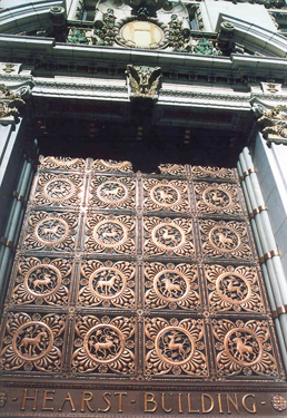
Here is the Hearst
Building on Market and 3rd street. If anything, the doorway is very
impressive. The building was built in 1909, replacing the original
Examiner Building that was destroyed in the 1906 earthquake.
 William
Randolph Hearst, the son of George Hearst, who made his fortune in the
California Gold Rush, received the newspaper, the San Francisco
Examiner, as a gift from his father. In 1887, he became the paper's
publisher and devoted long hours and much money to making it a success.
Crusading for civic improvement and exposing municipal corruption, he
greatly increased the paper's circulation.
William
Randolph Hearst, the son of George Hearst, who made his fortune in the
California Gold Rush, received the newspaper, the San Francisco
Examiner, as a gift from his father. In 1887, he became the paper's
publisher and devoted long hours and much money to making it a success.
Crusading for civic improvement and exposing municipal corruption, he
greatly increased the paper's circulation.
Later he
acquired The New York Journal and engaged in a bitter circulation war
with Joseph Pulitzer's New York World which led to the creation of
"yellow journalism" (sensationalized stories of dubious veracity).
Acquiring more newspapers, Hearst created a chain that numbered nearly
30 papers in major American cities at its peak. He later expanded to
magazines, creating the largest newspaper and magazine business in the
world.
He was elected two times to
the U.S. House of Representatives, but was defeated in 1906 in a race
for governor of New York. Nonetheless, through his newspapers and
magazines, he exercised enormous political influence, most notably in
creating public frenzy which pushed the U.S. into war with Spain in
1898. His life story was a source of inspiration for the lead character
in Orson Welles' classic film, Citizen
Kane.
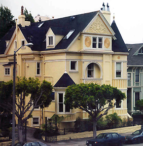 Not all
famous San Francisco
architecture is high-rises. There are many beautiful Victorian and
Queen
Anne homes throughout the city. Many of the homes are painted in bright
vivid colors. The building here is C.
A. Belden House, a Queen Anne Victorian in the Pacific
Heights section on Gough Street
Between Clay and Washington Streets. It was designed by Walter Matthews
in 1889. The house is on the National Register of Historic
Places in San Francisco.
Not all
famous San Francisco
architecture is high-rises. There are many beautiful Victorian and
Queen
Anne homes throughout the city. Many of the homes are painted in bright
vivid colors. The building here is C.
A. Belden House, a Queen Anne Victorian in the Pacific
Heights section on Gough Street
Between Clay and Washington Streets. It was designed by Walter Matthews
in 1889. The house is on the National Register of Historic
Places in San Francisco.  We walked
around
the Embarcadero Plaza (they
have a great water fountain there) and strolled through the Ferry
Building. This is one of the more famous landmarks of San Francisco.
After the earthquake in 1906 and during the fires, people made there
way here to catch ferries out of the city.
We walked
around
the Embarcadero Plaza (they
have a great water fountain there) and strolled through the Ferry
Building. This is one of the more famous landmarks of San Francisco.
After the earthquake in 1906 and during the fires, people made there
way here to catch ferries out of the city.
San Francisco's
shoreline historically ran south and inland from Clarke's Point below
Telegraph Hill to present-day Montgomery Street and eastward toward
Rincon Point, enclosing a cove named Yerba Buena Cove. As the city
grew, the cove was filled. Over fifty years a large offshore seawall
was built and the mud flats filled, creating what today is San
Francisco's Financial District. The San Francisco Belt Railroad, a
short line railroad for freight, ran along The Embarcadero. The roadway
follows the seawall, a boundary first established in the 1860s and not
completed until the 1920s.
During the early-20th
century when the seaport was at its busiest and before the construction
of the Bay Bridge, the plaza in front of the Ferry Building was one of
the busiest areas of foot traffic in the world; only Charing Cross
Station in London and Grand Central Station in New York City were
busier. More then 50 million passengers passed through here every year
on the 170 daily ferry crossings.
The Ferry Building (at
right) opened in 1903, replacing its wooden predecessor, and survived
both the 1906 earthquake and the 1989 earthquake with amazingly little
damage. In fact, the Ferry Building was one of the only avenues of
escape during the fire after the 1906 earthquake. On top of the
building is a large clock tower, which can be seen from Market Street.
Architecturally, the 235 ft. clock tower was modeled after the 12th
century
Giralda bell tower in Seville, Spain. During daylight, on every full
and half-hour, the clock bell can be heard chiming portions of the
Westminster Quarters.
During World War II,
San Francisco's waterfront became a military logistics center; troops,
equipment and supplies left the Port in support of the Pacific theater.
Almost every pier and wharf was involved in military activities, with
troop ships and naval vessels tied up all along the Embarcadero.
However, construction
of the Golden Gate Bridge and the San Francisco-Oakland Bay Bridge led
to the decline in the importance of ferries and the Ferry Building. The
transition to container shipping, which moved most shipping to Oakland,
led to further decline. Automobile transit efforts led to the
Embarcadero Freeway being built in the 1960s. This improved automobile
access to the Bay Bridge, but detracted aesthetically from the city.
For 30 years, the highway divided the waterfront and the Ferry Building
from downtown. It was torn down in 1991, after being severely damaged
in the 1989 Loma Prieta earthquake.
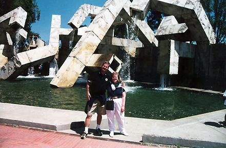 After
the freeway had been cleared, massive redevelopment began as a grand
palm-lined boulevard was created, squares and plazas were created
and/or restored. One of the things to see in Embarcardo Plaza is the
"Vaillancourt Fountain" (seen here). It is a huge concrete fountain,
200 feet long, 140 feet wide and 36 feet high. The stairs and walkways
that allow you to walk around and through the fountains pools and
columns of water.
After
the freeway had been cleared, massive redevelopment began as a grand
palm-lined boulevard was created, squares and plazas were created
and/or restored. One of the things to see in Embarcardo Plaza is the
"Vaillancourt Fountain" (seen here). It is a huge concrete fountain,
200 feet long, 140 feet wide and 36 feet high. The stairs and walkways
that allow you to walk around and through the fountains pools and
columns of water. Later, we took a
harbor cruise that took us under the Golden Gate Bridge and alongside
Alcatraz, though we didn't stop. You can really feel the current in the
harbor when you get next to the Golden Gate Bridge.
The park
was built back in the 1870s out of sand dune covered land known as the
"outside lands" in an unincorporated area west of what was then San
Francisco's border. In 1903, a pair of Dutch-style windmills were built
at the extreme
western end of the park. These pumped water throughout the park. The
north windmill has been restored to its original appearance and is
adjacent to a flower garden, a gift of Queen Wilhelmina of the
Netherlands that are usually planted with (of course) tulips.
Golden Gate
Park has a number of gardens, lakes
and museums in it. One of the museums we visited was the California
Academy of Science, one of the largest natural history museums in
the world which also houses the Steinhart Aquarium and the Morrison
Planetarium (which we did not visit). [NOTE:
Since 2004, the Academy's primary
buildings are currently closed for complete reconstruction with plans
to reopen in 2008]. It had an interesting exhibits on
earthquakes which is somewhat ironic since it was the 1989 Loma Prieta earthquake (the one that interrupted
the 1989 World Series) that caused damage to the buildings prompting
the current reconstruction.
 |
 |
Alcatraz
 On Sunday, July
3,
we spent a day at Alcatraz,
also known as "The Rock". This was a lot of fun. It is the most popular
attraction in San Francisco, the tickets are booked days in advance.
Debbie
tried to find a room for me there. They wouldn't take me, they said
they
only housed low-life scum and they wouldn't lower their standards for
anyone.
On Sunday, July
3,
we spent a day at Alcatraz,
also known as "The Rock". This was a lot of fun. It is the most popular
attraction in San Francisco, the tickets are booked days in advance.
Debbie
tried to find a room for me there. They wouldn't take me, they said
they
only housed low-life scum and they wouldn't lower their standards for
anyone.
The only way to visit Alcatraz is by boat and the only company that takes tourists there is the Blue & Gold Line (though I have heard that the boat company recently changed). I booked the tickets online before we left. It was a good thing I did, because there was a one-week waiting list for tickets. The weather on the day we went was incredible, warm and sunny (one of the two best days we had here). The boat uses the same dock that was used when Alcatraz was a prison. The first place you visit is the Visitor Center housed in the barracks building (on the opposite side of the island in the picture above). They have a museum, video about the prison and of course a bookstore/gift shop. What they don't have is a snack shop so don't come to the island hungry. All you can buy is water.
After this, you have to walk up to the top. There are four walkways that snake their way to the top. You enter the main building through it's main entrance. You go past the Control Room and the Visiting Areas. They don't have guided tours, only audio tours with headsets. So, you can walk around the Cell Block at your own pace.
 Outside near the main entrance,
you get a great view of downtown San Francisco and the San
Francisco-Oakland Bay Bridge (as you can see in the photo at left).
However, I wouldn't want to try and swim that distance.
Outside near the main entrance,
you get a great view of downtown San Francisco and the San
Francisco-Oakland Bay Bridge (as you can see in the photo at left).
However, I wouldn't want to try and swim that distance.
 Following the war in 1866
the army determined that the fortifications and guns were being rapidly
rendered obsolete by advances in military technology. They attempted
different plans to address the problem but never came up with a good
solution. Instead the army switched the focus of its plans for Alcatraz
from coastal defense to detention, a task for which it was well suited
because of its isolation.
Following the war in 1866
the army determined that the fortifications and guns were being rapidly
rendered obsolete by advances in military technology. They attempted
different plans to address the problem but never came up with a good
solution. Instead the army switched the focus of its plans for Alcatraz
from coastal defense to detention, a task for which it was well suited
because of its isolation. The
government converted it into a maximum-security Federal Penitentiary in
1934. The Great Depression and Prohibition
contributed to a severe increase in crime during the late 1920s and
1930s, heralding organized crime. There was a sharp rise in serious
violence, provoked by Prohibition and poverty. Gangsters and other
"public enemies" gained influence in metropolitan areas and law
enforcement agencies were not equipped to deal with the situation,
frequently bested by better-armed gangs in shoot-outs. Alcatraz was
perceived as the best solution. It could keep public
enemies away from the population and be a warning to the new, ruthless
brand of criminals (photo at right is of me in a
mock-up jail cell in the Alcatraz Restaurant back on Pier 39 - I look
ruthless).
The
government converted it into a maximum-security Federal Penitentiary in
1934. The Great Depression and Prohibition
contributed to a severe increase in crime during the late 1920s and
1930s, heralding organized crime. There was a sharp rise in serious
violence, provoked by Prohibition and poverty. Gangsters and other
"public enemies" gained influence in metropolitan areas and law
enforcement agencies were not equipped to deal with the situation,
frequently bested by better-armed gangs in shoot-outs. Alcatraz was
perceived as the best solution. It could keep public
enemies away from the population and be a warning to the new, ruthless
brand of criminals (photo at right is of me in a
mock-up jail cell in the Alcatraz Restaurant back on Pier 39 - I look
ruthless).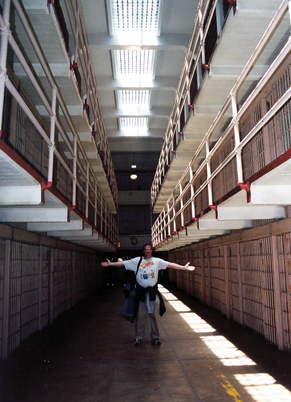 always in the exact same places
in a unified formation. There was a ratio of one guard to every three
prisoners on Alcatraz, as
compared with other prisons, in which the ratio exceeded one guard to
every twelve inmates, a measure which was meant to prevent the
prisoners from trying to escape.
always in the exact same places
in a unified formation. There was a ratio of one guard to every three
prisoners on Alcatraz, as
compared with other prisons, in which the ratio exceeded one guard to
every twelve inmates, a measure which was meant to prevent the
prisoners from trying to escape. The tour takes you through the
center aisle of the main cell
block
(photo on right) was called "Broadway" by the inmates. The cells along
this passageway were considered the least desirable in
the prison. The cells on the bottom tier were colder because they stood
against the long slick run of cement, and they were also the least
private, as inmates, guards and other prison personnel frequented this
corridor.
 The tour
points out Al
Capone's cell
(or what they believed was his cell - he spent most of his time in the
prison hospital). You can also see the cells where Frank Morris was
along with the items they used in their 1962
breakout. They also show you the library, Robert Stroud's cell (the
birdman)
and George "Machine Gun" Kelly's (photo above left) cell.
The tour
points out Al
Capone's cell
(or what they believed was his cell - he spent most of his time in the
prison hospital). You can also see the cells where Frank Morris was
along with the items they used in their 1962
breakout. They also show you the library, Robert Stroud's cell (the
birdman)
and George "Machine Gun" Kelly's (photo above left) cell.
George "Machine Gun" Kelly (1895-1954) was a notorious American gangster during the prohibition era (Roaring Twenties). After his conviction for kidnapping wealthy oil tycoon Charles Urschel in 1933, Kelly would spend 21 years in prison. The warden at Alcatraz called Kelly a 'model prisoner'. After Alcatraz, he was sent to Leavenworth Federal Prison, Kansas where he died of a heart attack on his 59th birthday.
After
this, you go into the
Dinning Room and
Kitchen.
From there, you can enter the  Recreation Area outside. This is the
walled
area you always see in Alcatraz movies (photo at right). You can see
the
steps that the inmates would sit on during their time in this area in
the center of the photo. The funny thing
was the day was sunny and warm without a breeze on the island until we
went into the recreation area which had
a stiff cold wind blowing. After leaving the main
buildings, we relaxed
outside
near the lighthouse and what is left of the Warden's House. Only the
sell
remains after a fire during the American Indian Occupation in 1969-71.
Recreation Area outside. This is the
walled
area you always see in Alcatraz movies (photo at right). You can see
the
steps that the inmates would sit on during their time in this area in
the center of the photo. The funny thing
was the day was sunny and warm without a breeze on the island until we
went into the recreation area which had
a stiff cold wind blowing. After leaving the main
buildings, we relaxed
outside
near the lighthouse and what is left of the Warden's House. Only the
sell
remains after a fire during the American Indian Occupation in 1969-71.
Another thing I learned was that Robert Stroud, who was portrayed by Burt Lancaster in the 1962 movie Birdman of Alcatraz, was not allowed to have any birds here. It was a nickname he brought with him from his previous prison. Also, despite Lancaster's portrayal in the movie, Stroud was not a very nice person. Burt Lancaster’s impersonation of Stroud stirred sympathy with the general public. However, prison historians have pointed out that the real Stroud was a merciless killer who showed no remorse for his crimes. I also learned about the prison uprising in 1946 that led to the deaths of two guards and three inmates in what was called "The Battle of Alcatraz". Two of the ring leaders were executed for the murders. Also, they were executed at San Quentin Prison not at Alcatraz did not carry out death sentences.
Alcatraz has been a popular movie setting since it's closure. Birdman of Alcatraz in 1962 with Burt Lancaster, though not filmed on the island used exterior shots for the film. Point Blank in 1967 starring Lee Marvin and Angie Dickinson. This was the first major motion picture to be filmed on location at Alcatraz Island after the closure. The Enforcer in 1976 was the third installment in the Dirty Harry series where terrorists use Alcatraz after the Mayor of San Francisco is kidnapped. Escape from Alcatraz in 1979 (where 15 miles of cable were required to reconnect the island to the city's electricity). More famously was The Rock in 1996 that used Alcatraz as the base of hostage situation, starring Sean Connery and Nicolas Cage, with Ed Harris as a renegade general controlling the location of the rockets and renegades. In this film, Alcatraz became as much a star as Connery, Cage and Harris.
Pacific Bell Park
 On Monday, July
4th,
we went to a San
Francisco Giants game at Pacific
Bell Park. This place is
fantastic.
You can walk here from downtown San Francisco. We saw the Giants beat
the
Colorado Rockies, 4-1. As you can see, we became Giant fans for the
day.
This was Debbie's first ever baseball game. You can also see the
sunburn
that we got, especially Debbie. This is without a doubt one of the more
enjoyable places to watch a baseball game. We had great seats, first
row
in the upperdeck. After the game, we walked back downtown.
On Monday, July
4th,
we went to a San
Francisco Giants game at Pacific
Bell Park. This place is
fantastic.
You can walk here from downtown San Francisco. We saw the Giants beat
the
Colorado Rockies, 4-1. As you can see, we became Giant fans for the
day.
This was Debbie's first ever baseball game. You can also see the
sunburn
that we got, especially Debbie. This is without a doubt one of the more
enjoyable places to watch a baseball game. We had great seats, first
row
in the upperdeck. After the game, we walked back downtown.
 The
Giants moved to San
Francisco from New York in 1958. Owner Horace Stoneham left New York
primarily because the Polo Grounds had inadequate parking and
attendance was suffering. Their first home was Seals Stadium (home of
the minor league San Francisco Seals - former team of Joe DiMaggio)
while their new stadium was being built. In their opening game, they
shutout the Dodgers and future Hall of Famer Orlando Cepeda homered in
his first major league game. Two years later, they moved to Candlestick
Park. On hand at the opening day ceremony was President Richard Nixon
and Hall of Famer Ty Cobb (interesting pair of personalities). The
Giants went on to beat the Cardinals 3-1. Later that year, the All-Star
Game was held at Candlestick, which quickly became famous for it's
windy conditions. This year, after 40 years in Candlestick Park, they
moved to their new stadium, Pacific Bell Park. Earlier this year,
breaking a tradition of winning opening game in new stadiums, the
Giants lost their opener, along with the next five games.
The
Giants moved to San
Francisco from New York in 1958. Owner Horace Stoneham left New York
primarily because the Polo Grounds had inadequate parking and
attendance was suffering. Their first home was Seals Stadium (home of
the minor league San Francisco Seals - former team of Joe DiMaggio)
while their new stadium was being built. In their opening game, they
shutout the Dodgers and future Hall of Famer Orlando Cepeda homered in
his first major league game. Two years later, they moved to Candlestick
Park. On hand at the opening day ceremony was President Richard Nixon
and Hall of Famer Ty Cobb (interesting pair of personalities). The
Giants went on to beat the Cardinals 3-1. Later that year, the All-Star
Game was held at Candlestick, which quickly became famous for it's
windy conditions. This year, after 40 years in Candlestick Park, they
moved to their new stadium, Pacific Bell Park. Earlier this year,
breaking a tradition of winning opening game in new stadiums, the
Giants lost their opener, along with the next five games. After the game, we walked back to
Market Street and took a bus back to Van Ness Avenue. We were meeting
Bro. Ray Murphy for dinner. Bro. Ray is a teacher at Hudson Catholic
who spends his summers in San Francisco. We ate at a restaurant on Van
Ness Avenue, not too far from his school. After dinner, we said our
good-byes and proceeded to walk downtown. We walked around City Hall
and
headed back toward Fisherman's Wharf. They had a July 4th fireworks
display over San Francisco Bay. After the fireworks, we walked back to
the hotel. It was a hike, but the lines for the cable cars were just
too long.
 The City Hall of San
Francisco opened in 1915, in its open space area in the city's Civic Center, is a Beaux-Arts monument to
the "City Beautiful" movement that
epitomized the American Renaissance period from 1880 to 1917. The
architect was Arthur Brown Jr., whose
attention to the finishing details extended to the doorknobs. Brown
also designed San Francisco's War Memorial
Opera House and the Coit Tower.
The City Hall of San
Francisco opened in 1915, in its open space area in the city's Civic Center, is a Beaux-Arts monument to
the "City Beautiful" movement that
epitomized the American Renaissance period from 1880 to 1917. The
architect was Arthur Brown Jr., whose
attention to the finishing details extended to the doorknobs. Brown
also designed San Francisco's War Memorial
Opera House and the Coit Tower.
The building is vast, totaling over
500,000 square feet
and occupying two full blocks of San Francisco. It is 390 feet long on
Van Ness Avenue and Polk Street, by 273 feet on Grove and McAllister
Streets. Its dome, which owes much to Mansart's
Baroque dome of Les Invalides, Paris (where Napoleon's tomb is), is the
fifth largest dome in the world, rising 307.5 feet above the Civic
Center Historic District. It is fourteen inches higher than the United
States Capitol, and has a diameter of 66 feet.
President Warren G. Harding lay in
state at City Hall after dying of a heart attack at the Palace Hotel in
1923. Joe DiMaggio and Marilyn Monroe were married at City Hall in
1954. Mayor George Moscone and Supervisor Harvey Milk were assassinated
there in 1978, by former Supervisor Dan White.
 The exterior is
built with gray California granite with blue and gold burnished
ironwork. The dome itself has $400,000 worth of gold covering it. We
walked through the interior which is spectacular. The interior is
finished in California marble, Indiana limestone and
Eastern oak. From the center of the lobby, which is approximately 75
feet square, there is a wide marble staircase
that leads to the second-floor gallery.
The exterior is
built with gray California granite with blue and gold burnished
ironwork. The dome itself has $400,000 worth of gold covering it. We
walked through the interior which is spectacular. The interior is
finished in California marble, Indiana limestone and
Eastern oak. From the center of the lobby, which is approximately 75
feet square, there is a wide marble staircase
that leads to the second-floor gallery.
 This is the fifth city hall that San Francisco has had.
The fourth was a large steel, granite and brick building that was
started in 1872 at Larkin and McAllister streets, a block from here. It
took $6 million, 27 years and a host of scandals before it was
completed in 1899.
This is the fifth city hall that San Francisco has had.
The fourth was a large steel, granite and brick building that was
started in 1872 at Larkin and McAllister streets, a block from here. It
took $6 million, 27 years and a host of scandals before it was
completed in 1899.
Seven years later, on
April 18, 1906, the famous San Francisco Earthquake with a magnitude of
8.3 on the Richter scale
subjects old City Hall to peak ground acceleration of from .40 to .60
gravity forces. The building that took 27 years to build falls in 28
seconds of significant seismic motion with only the dome remaining
intact. The
old photo above is of the old city hall after the earthquake and fire
(click here
for pre-earthquake photo).
 On April 15, 1913, Mayor "Sunny Jim" Rolph broke
ground on San
Francisco's current City Hall. They decided not to use the old
triangular site but moved the new building a block away. The old site
of the city hall was used for the new library instead. It took only
three years and only $3.5 million to
build (good for Sunny Jim!). Rolph, a Republican, served as mayor of
San Francisco from 1912 to 1931, when he resigned to become governor. Rolph
remains the longest serving mayor in San
Francisco history. In
1934, while serving as Governor of California, "Sunny Jim" Rolph dies
and his body lies in state in the rotunda of City Hall.
On April 15, 1913, Mayor "Sunny Jim" Rolph broke
ground on San
Francisco's current City Hall. They decided not to use the old
triangular site but moved the new building a block away. The old site
of the city hall was used for the new library instead. It took only
three years and only $3.5 million to
build (good for Sunny Jim!). Rolph, a Republican, served as mayor of
San Francisco from 1912 to 1931, when he resigned to become governor. Rolph
remains the longest serving mayor in San
Francisco history. In
1934, while serving as Governor of California, "Sunny Jim" Rolph dies
and his body lies in state in the rotunda of City Hall.
The Loma Prieta earthquake of 1989, with a magnitude of 7.1 on the Richter scale, damaged current the structure and twisted the dome four inches on its base. Afterwards work was undertaken to render City Hall earthquake resistant through a base isolation system. In an earthquake, the mass of the dome acts as a pendulum, rocking the building's structure and tearing it apart. The base isolation system of hundreds of rubber and stainless-steel insulators inserted into City Hall's underpinnings has the effect of disrupting seismic waves before they can affect the structure. San Francisco's City Hall is currently the world's largest base-isolated structure—a triumph of seismic retrofitting. The city completed a $293 million upgrade and seismic retrofit in 1998.
The beauty of City Hall has
not been lost on filmmakers working in San
Francisco; a good many films have shot scenes in and around the
building. Ironically, that which may be City Hall's best-known scene
does not take place in San Francisco but in Washington, DC. A scene in Raiders
of the Lost Ark
was filmed in the rotunda as a late addition to the production when it
was decided that a coda was needed for Indiana Jones and Marion
Ravenwood's relationship. The City Hall was prominently featured
throughout and famously at the end of the 1978 version of the Invasion
of the Body Snatchers. Dirty Harry filmed a key scene in
the Mayor's office itself. Exterior shots for A View to a Kill, where the
building is set on fire, and The Rock
were also done here.
 Look at this wild person riding the famous
San
Francisco cable cars. I,
however, was the one who fell off. Actually, I jumped off and ended up
falling in the street. I was trying to retrieve a camera lens that
slipped
out of my hand. I'm sure it was humorous to everyone else there.
Look at this wild person riding the famous
San
Francisco cable cars. I,
however, was the one who fell off. Actually, I jumped off and ended up
falling in the street. I was trying to retrieve a camera lens that
slipped
out of my hand. I'm sure it was humorous to everyone else there.
 The San
Francisco cable cars are the only moving National Historic Landmarks in
the United States, San Francisco's cable cars constitute the oldest and
largest such system in permanent operation, and it is the only one to
still operate in the traditional manner with manually operated cars
running in street traffic.
The San
Francisco cable cars are the only moving National Historic Landmarks in
the United States, San Francisco's cable cars constitute the oldest and
largest such system in permanent operation, and it is the only one to
still operate in the traditional manner with manually operated cars
running in street traffic.
Cable cars were first used in
San Francisco in
1876. There were cable cars lines on many streets throughout the city.
After the Great Earthquake on 1906, many of the cable car lines
were damaged. By 1912, only eight were in service. By World War II,
many more closed down. In 1947, the mayor wanted to end all cable car
service. A public campaign saved the cable cars. Today, there are three
cable cars lines in operation.
At Powell and Market
streets, there is a cable car turntable which serves as the beginning
stop
for two lines, the Powell-Mason
and
Powell-Hyde lines.
The Powell-Mason line begins at
the
Powell/ Market turntable (pictured below right), and the line runs from
there
up and over Nob
Hill
and down to Bay Street at Fisherman's Wharf. The Powell-Hyde line also begins at the
Powell Market turntable and runs over Nob and Russian hills
before ending at Aquatic
Park
near Ghirardelli Square. Both these lines end near Fisherman's Wharf,
but
at different areas, and the routes are significantly different. Why the
turntable? At the end of the line, the cable car is manually turned
around by the conductor and gripman (and sometimes a willing passenger
or two) so it can go in the other direction.
 The
other line runs east/west along California
Street. These cable cars run from either direction (which means that
don't have to be manually turned around) from downtown next to the
Financial District, through Chinatown,
over Nob Hill and up to Van Ness Avenue about a block from our hotel.
The
other line runs east/west along California
Street. These cable cars run from either direction (which means that
don't have to be manually turned around) from downtown next to the
Financial District, through Chinatown,
over Nob Hill and up to Van Ness Avenue about a block from our hotel.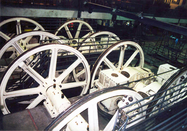 Riding
the cable cars is, of course, a must when anyone visits San Francisco,
but don't forget to visit the Cable
Car Barn & Powerhouse on the corner of Mason and Washington
Streets. The museum, which is inside the city's last cable-car barn,
takes the top off the system to let you see how it all works. Eternally
humming and squealing, the massive powerhouse cable wheels steal the
show (at left).
Riding
the cable cars is, of course, a must when anyone visits San Francisco,
but don't forget to visit the Cable
Car Barn & Powerhouse on the corner of Mason and Washington
Streets. The museum, which is inside the city's last cable-car barn,
takes the top off the system to let you see how it all works. Eternally
humming and squealing, the massive powerhouse cable wheels steal the
show (at left).
You might ask, what makes
cable cars run, especially on the
steep hills of San Francisco. This is where you can find out. You see
the cable cars don't have any motors. The cable car begins moving when
a clamping device, called a grip, is connected to the moving cable, and
applies pressure. Conversely the car is stopped by releasing pressure
on the cable (with or without completely detaching) and applying the
brakes. So, when
they
want to move, the operators moves a large lever that causes the cable
car
to grip the cable below the street. The cable is moving all of the time
in one direction. It works like a tow lift at a ski resort. The tow
line keeps moving and you grab it when you are reading to go up the
hill.
 Every
cable car has two men on board. One man, the conductor, handles
collecting fares. The other man, called the gripman, handles the
operation of the cable car and is usually dressed more elaborately
(Some
gripmen are locally well-known personalities). The gripman has to have
a lot of upper body strength. Only a portion of the people who attempt
the training course actually pass (about 30%). The levers are not easy
to move. In 1998, the first female grip operator, Fannie Mae Barnes,
operates a cable car. The grip resembles a very large pair of pliers,
and considerable strength and skill are required to operate the car. As
many early cable car operators discovered the hard way, if the grip is
not applied properly, it can damage the cable, or even worse, become
entangled in the cable. In the latter case, the cable car may not be
able to stop and can wreak havoc along its route until the cable house
realizes what is going on and stops the cable.
Every
cable car has two men on board. One man, the conductor, handles
collecting fares. The other man, called the gripman, handles the
operation of the cable car and is usually dressed more elaborately
(Some
gripmen are locally well-known personalities). The gripman has to have
a lot of upper body strength. Only a portion of the people who attempt
the training course actually pass (about 30%). The levers are not easy
to move. In 1998, the first female grip operator, Fannie Mae Barnes,
operates a cable car. The grip resembles a very large pair of pliers,
and considerable strength and skill are required to operate the car. As
many early cable car operators discovered the hard way, if the grip is
not applied properly, it can damage the cable, or even worse, become
entangled in the cable. In the latter case, the cable car may not be
able to stop and can wreak havoc along its route until the cable house
realizes what is going on and stops the cable.
On the second or third Thursday each
July, a cable car bell ringing contest is held in Union Square between
cable car crews, following a preliminary round held during the second
to last or the last week of June. The preliminary round determines
which contestants go on to the finals in Union Square, by a process of
points awarded by a panel of judges.
You may also ask, ok I know how they
move, but how do they stop? San Francisco cable cars are equipped with
multiple braking systems. The large pedal next to the grip (and a crank
on the back platform of single-ended cars) operates wheel brakes; the
large lever to the right of the grip operates track brakes, which apply
pine blocks directly to the rails. It is the track brakes that are the
source of the "cooking wood" odor that can be readily smelled when a
car is descending a steep hill. Finally, in case of a runaway car or
other impending disaster, the red lever to the left of the grip inserts
a steel wedge (the "slot blade") into the slot rail, stopping the car
almost instantly; slot blades have been known to weld themselves into
the slot, leaving both car and line out of commission until it can be
cut free.
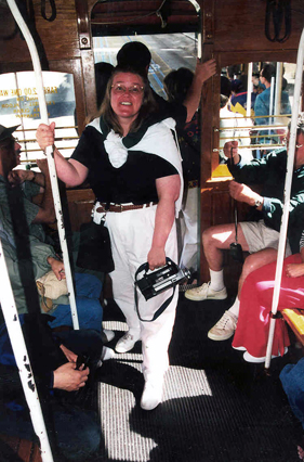
Here you can see that Debbie
has decided to ride on the inside of the cable car. You can also sit on
benches that face the outside. However, if you like, you can "hang on"
to the special poles provided on the outside of the car like Debbie is
doing above.
Also be careful when crossing the
street when a cable car is coming at you. Because of the constant and
relatively low speed, cable cars can be underestimated in an accident.
Even with a cable car traveling at only 9 miles per hour, the mass of
the cable car and the combined strength of the cables can do quite a
lot of harm to pedestrians if hit.
 On another day,
we walked from out
hotel west into the Pacific Heights area. There are many old and very
beautiful Victorian homes here. Some are painted in extraordinary color
schemes. We walked along Washington Street through Lafayette Park and
down to Alta Plaza. We eventually came to the Palace of Fine Arts.
On another day,
we walked from out
hotel west into the Pacific Heights area. There are many old and very
beautiful Victorian homes here. Some are painted in extraordinary color
schemes. We walked along Washington Street through Lafayette Park and
down to Alta Plaza. We eventually came to the Palace of Fine Arts.
In playing host to the
Panama-Pacific International Exposition, The Fair, which opened on
February 20, 1915, San Francisco was honoring the discovery of the
Pacific Ocean and the completion of the Panama Canal; it was also
celebrating its own resurrection after the destructive earthquake and
fire of 1906.
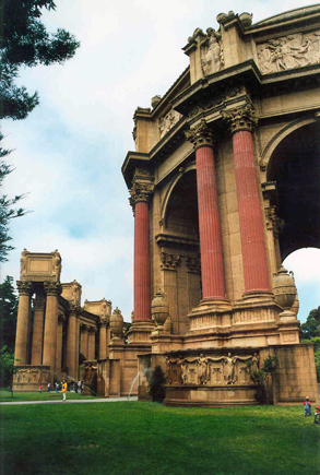
This
is the sole survivor from the 1915 Panama-Pacific Exposition. It was
designed by Bernard Maybeck, who chose as his theme a Roman ruin,
mutilated and overgrown. It was one of only two buildings from the
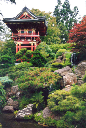
exposition not to be demolished (the other being the Japanese Tea
House, not the one in Golden Gate Park which dates from an 1894 fair)
when the exposition was over. A single dome remains from the eight
identical structures that were originally constructed. Towering
colonnaded walkways linked the buildings on the site, but only a few
remain intact. Today it is a large outdoor park that is a favorite
wedding location for couples throughout the San Francisco Bay Area.
The other building saved is the
exhibition hall, which originally housed Impressionist paintings during
the exposition, and is now home to the Exploratorium, a state of the
art interactive science museum.
There is a lagoon here which
was intended to echo those found in classical settings in Europe, where
the expanse of water provides a mirror surface to reflect the grand
buildings and an undisturbed vista to appreciate them from a distance.
In many places the edges are subsiding into the water, forming uneven
and dangerous surfaces that are fenced off from the public and used by
turtles to sun themselves. Australian eucalyptus trees fringe the
eastern shores. Many forms of wildlife have made their home there
including swans, ducks, geese, turtles and frogs.
The dome of the Palace of Fine
Arts just outside the Exploratorium and the adjacent lagoon have often
been used as backdrops for movies, such as Alfred Hitchcock's Vertigo. In 1979's Time After Time, several scenes
including one between (Malcolm McDowell) and (Mary Steenburgen) as well
as the climax stand off with (David Warner). One of the more recent
sequences takes place in The Rock,
where FBI agent Stanley Goodspeed (Nicolas Cage) finally catches up
with John Mason (Sean Connery) after a long chase through the streets
of San Francisco (where a cable car is destroyed - not a real one of
course).
Next to the Palace is The
Presidio. What was once a military base on the northern tip of
the San Francisco Peninsula, is now a large 1,491 acre park (with
almost 1,000 acres being open space).
It is operated by the National Park Service of the United States as a
part of the Golden Gate National Recreation Area. The largest area, the
"Main Post," is managed by the Presidio Trust, a congressionally
chartered nonprofit organization.
The Presidio was originally a
Spanish Fort sited by Juan Bautista de Anza on March 28, 1776, built by
a party led by José Joaquín Moraga later that year. It
was seized by the U.S. Military in 1846, officially opened in 1848, and
became home to several Army headquarters and units, the last being the
United States 6th Army. Several famous U.S. generals, such as William
Sherman, George Henry "The Rock of Chickamauga" Thomas and John "Black
Jack" Pershing, lived here at one time. The infamous order to intern
Japanese-Americans, German-Americans and Italian-Americans, including
citizens, during World War II was signed at the Presidio. Until its
closure in 1995, the Presidio was the longest continuously operated
military base in the United States.
 One of
the ironies of war occurred here. In 1860, as Southern states started
seceding from the Union prior to the outbreak of the Civil War, a U.S.
Army colonel, Albert Sydney Johnston, protected Union weapons from
being taken by Southern sympathizers in San Francisco. When his home
state seceded on April 9, 1861, Johnston resigned his commission and
later became a general in the Confederate Army. Considered one of their
best generals, he was killed on the first day at the Battle of Shiloh
in 1862.
One of
the ironies of war occurred here. In 1860, as Southern states started
seceding from the Union prior to the outbreak of the Civil War, a U.S.
Army colonel, Albert Sydney Johnston, protected Union weapons from
being taken by Southern sympathizers in San Francisco. When his home
state seceded on April 9, 1861, Johnston resigned his commission and
later became a general in the Confederate Army. Considered one of their
best generals, he was killed on the first day at the Battle of Shiloh
in 1862.
The base
was once featured in a 1988 movie, The
Presidio, also staring Sean Connery. It was decommissioned as a
military base. It now has museums, though the military museum was
closed when we were there.
We also visited the military
cemetery (of
course). They do have one Civil War general buried here. General
Irwin McDowell commanded the Union Army in the early days of the
war and was defeated by the Confederates in the first major battle of
the war, Bull Run. After he retired, he moved to California and died
here in 1885 of a heart attack.
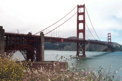 We
decided one morning to
walk across the Golden Gate Bridge.
Designed by Joseph Strauss (whose statue is next to the bridge in the
park on the San Francisco side), the bridge opened in 1937 at a cost of
$35 million dollars. It is considered one of the most famous bridges in
the world.
We
decided one morning to
walk across the Golden Gate Bridge.
Designed by Joseph Strauss (whose statue is next to the bridge in the
park on the San Francisco side), the bridge opened in 1937 at a cost of
$35 million dollars. It is considered one of the most famous bridges in
the world.  Although the idea of a
bridge spanning the Golden Gate was not new the physical constraints
and
the estimated cost made it seem impossible. One designer Joseph Strauss
submitted a plan that was accepted. The bridge faced opposition,
including litigation, from many sources. The military was afraid it
could be destroyed and block access to the harbor and their naval
bases. The ferry service knew it would destroy their business. However,
the bridge builders won out.
Although the idea of a
bridge spanning the Golden Gate was not new the physical constraints
and
the estimated cost made it seem impossible. One designer Joseph Strauss
submitted a plan that was accepted. The bridge faced opposition,
including litigation, from many sources. The military was afraid it
could be destroyed and block access to the harbor and their naval
bases. The ferry service knew it would destroy their business. However,
the bridge builders won out.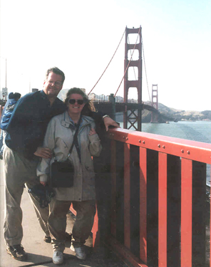 safety netting beneath the construction
site, which saved the lives of many otherwise unprotected steelworkers.
Of eleven men killed from falls during construction, ten were killed
(when the bridge was near completion) when the net failed under the
stress of a scaffold that had fallen. Nineteen others who were saved by
the net over the course of construction became proud members of the
(informal) Halfway to Hell Club.
safety netting beneath the construction
site, which saved the lives of many otherwise unprotected steelworkers.
Of eleven men killed from falls during construction, ten were killed
(when the bridge was near completion) when the net failed under the
stress of a scaffold that had fallen. Nineteen others who were saved by
the net over the course of construction became proud members of the
(informal) Halfway to Hell Club. There is
a museum and gift
shop next to a park on
the San Francisco side. You can also park your car there if you want to
walk across. From there we set out north to Marin County over a mile
away. We walked along the south side of the bridge along the sidewalks,
which are around ten feet wide. The weather was beautiful when we
walked across so we had incredible views of San Francisco Bay and the
city itself. It took us a couple of hours to make the roundtrip, but it
definitely worth it. This picture on the right is one of my favorites.
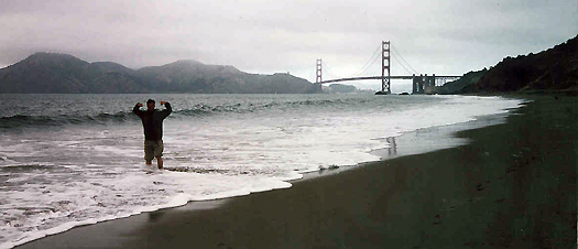 West of
the Golden Gate Bridge is
Baker Beach. This is a very popular fishing and sunbathing area along
the Pacific Ocean called "the largest and most popular stretch of sand
in the city." Baker Beach is part of the Presidio and is roughly a half
mile long, beginning just south of Golden Gate Point
(where the Golden Gate Bridge connects to the San Francisco Peninsula),
extending southward toward the Seacliff peninsula and the Palace of the Legion of Honor and the Sutro
Baths. There is no swimming here because the currents are too
strong. The photo shows the beach with the Golden Gate Bridge in the
background and the Marin Peninsula across the stretch of water called
the Golden Gate. Here is a picture Debbie took of some crazy tourist
about to be washed into the
Pacific Ocean.
West of
the Golden Gate Bridge is
Baker Beach. This is a very popular fishing and sunbathing area along
the Pacific Ocean called "the largest and most popular stretch of sand
in the city." Baker Beach is part of the Presidio and is roughly a half
mile long, beginning just south of Golden Gate Point
(where the Golden Gate Bridge connects to the San Francisco Peninsula),
extending southward toward the Seacliff peninsula and the Palace of the Legion of Honor and the Sutro
Baths. There is no swimming here because the currents are too
strong. The photo shows the beach with the Golden Gate Bridge in the
background and the Marin Peninsula across the stretch of water called
the Golden Gate. Here is a picture Debbie took of some crazy tourist
about to be washed into the
Pacific Ocean.|
San
Francisco Earthquakes
 On April 18, 1906 at 5:12 in the morning, the ground in
San
Francisco shook violently for up to a minute. The magnitude of the
earthquake has been estimated to be around 8.25 on the Richter scale
(By comparison, the Loma Prieta earthquake in 1989
registered 6.9). Though the earthquake caused considerable death and
damage, the greatest destruction came from the fires the quake ignited.
The fire raged for three days and destroyed around 490 square blocks
and 25,000 buildings. In the end, over 3,000 people were killed and
225,000 people injured. The picture is looking down Sacramento Street
as the fires approach.
On April 18, 1906 at 5:12 in the morning, the ground in
San
Francisco shook violently for up to a minute. The magnitude of the
earthquake has been estimated to be around 8.25 on the Richter scale
(By comparison, the Loma Prieta earthquake in 1989
registered 6.9). Though the earthquake caused considerable death and
damage, the greatest destruction came from the fires the quake ignited.
The fire raged for three days and destroyed around 490 square blocks
and 25,000 buildings. In the end, over 3,000 people were killed and
225,000 people injured. The picture is looking down Sacramento Street
as the fires approach.The Loma Prieta earthquake, also known as the Quake of '89 and the World Series Quake, was a major earthquake that struck the San Francisco Bay Area of California on October 17, 1989 at 5:04 p.m. Caused by a slip along the San Andreas Fault, the 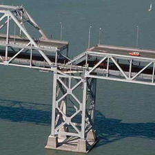 earthquake lasted approximately 15 seconds and
measured 6.9 on the moment magnitude scale (surface-wave magnitude
7.1). The quake killed 67 people throughout northern California,
injured 3,757 people and left some 8,000 to 12,000 people homeless. earthquake lasted approximately 15 seconds and
measured 6.9 on the moment magnitude scale (surface-wave magnitude
7.1). The quake killed 67 people throughout northern California,
injured 3,757 people and left some 8,000 to 12,000 people homeless. The earthquake occurred during the warm up for the third game of the 1989 World Series, coincidentally featuring both of the Bay Area's Major League Baseball teams, the Oakland Athletics and the San Francisco Giants. This was the first major earthquake in America to be broadcast on live television. The highest concentration of fatalities, 42, occurred in the collapse of the Cypress Street Viaduct on the Nimitz Freeway (Interstate 880 and ) in Oakland, where a double-decker portion of the freeway collapsed, crushing the cars on the lower deck. When the earthquake hit, Game 3 of World Series was just starting. Due to the fact that both of the World Series teams, the Giants and the A's, were local teams, many people had left work early to watch the game. As a consequence, the usually crowded freeways were experiencing exceptionally light traffic. If traffic had been normal for a Tuesday rush hour, injuries and deaths could have been higher. The photo is of the San Francisco-Oakland Bay Bridge. |
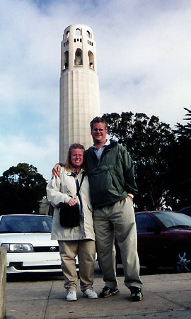 Telegraph Hill, originally named
Loma Alta ("High Hill") by the Spaniards, is a 284 ft
high hill familiarly known as Goat Hill by the early San
Franciscans. It later became the neighborhood of choice for many Irish
immigrants. The hill owes its current name to a semaphore, a
windmill-like structure erected in September 1849, for the purpose of
signaling to the rest of the city the nature of the ships, like what
cargo they were carrying, entering the Golden Gate. On October 18,
1850, the ship Oregon
signaled to the hill as it was entering the Golden Gate the news of
California's recently acquired statehood. A much quieter neighborhood
than adjoining North Beach with its bustling cafés and
nightlife, Telegraph Hill is a mostly residential area. Aside from Coit
Tower, it is well-known for its gardens flowing down Filbert Street to
Levi's Plaza. Telegraph Hill is also known for supporting a flock of
feral parrots (primarily Red-masked Parakeets), most of whom are
descended from escaped or released pets.
Telegraph Hill, originally named
Loma Alta ("High Hill") by the Spaniards, is a 284 ft
high hill familiarly known as Goat Hill by the early San
Franciscans. It later became the neighborhood of choice for many Irish
immigrants. The hill owes its current name to a semaphore, a
windmill-like structure erected in September 1849, for the purpose of
signaling to the rest of the city the nature of the ships, like what
cargo they were carrying, entering the Golden Gate. On October 18,
1850, the ship Oregon
signaled to the hill as it was entering the Golden Gate the news of
California's recently acquired statehood. A much quieter neighborhood
than adjoining North Beach with its bustling cafés and
nightlife, Telegraph Hill is a mostly residential area. Aside from Coit
Tower, it is well-known for its gardens flowing down Filbert Street to
Levi's Plaza. Telegraph Hill is also known for supporting a flock of
feral parrots (primarily Red-masked Parakeets), most of whom are
descended from escaped or released pets. between Kearny and Broadway
is named after Jack Kerouac who once lived here and frequented the
renowned (as well as a municipal landmark) City Lights Bookstore on the
corner of Columbus and Broadway as well as the numerous coffee shops
here. Baseball legend Joe Dimaggio grew up in the neighborhood and
briefly returned to live here with his wife Marilyn Monroe. There is no
shortage of Italian restaurants and cafés in North Beach.
between Kearny and Broadway
is named after Jack Kerouac who once lived here and frequented the
renowned (as well as a municipal landmark) City Lights Bookstore on the
corner of Columbus and Broadway as well as the numerous coffee shops
here. Baseball legend Joe Dimaggio grew up in the neighborhood and
briefly returned to live here with his wife Marilyn Monroe. There is no
shortage of Italian restaurants and cafés in North Beach.|
The
Big Four
 The Big Four was the name popularly given to the chief
entrepreneurs in the building of the Central Pacific Railroad, the
western portion of the First Transcontinental Railroad in the United
States. However, the four of them preferred to be known as "The
Associates". The four railroad tycoons were extremely rich and
powerful. They are all on the list of "The Wealthiest 100 Americans of
All Time." They all built beautiful mansions near other on Nob Hill in
San Francisco.
The Big Four was the name popularly given to the chief
entrepreneurs in the building of the Central Pacific Railroad, the
western portion of the First Transcontinental Railroad in the United
States. However, the four of them preferred to be known as "The
Associates". The four railroad tycoons were extremely rich and
powerful. They are all on the list of "The Wealthiest 100 Americans of
All Time." They all built beautiful mansions near other on Nob Hill in
San Francisco. Leland Stanford (1824-1893), who photo is at right, was the president of the Central Pacific Railroad. A Republican, he became the 8th Governor of California and also founded Stamford University (which is actually named after his son who died at age 15). Collis P. Huntington (1821-1900) was the vice-president of the railroad. He acquired a substantial collection of art, valued at some $3 million, which he left to the Metropolitan Museum of Art in New York City. Mark Hopkins (1813-1878) was the treasurer of the railroad. Before the Civil War, Hopkins was an Abolitionist and an organizer of the Republican Party in California. Charles Crocker (1822-1888) was the construction supervisor who managed the actual construction of the railroad. He overcame shortages of manpower and money by hiring Chinese immigrants to do much of the back-breaking and dangerous labor. |
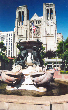 Nob
Hill is another interesting place to visit. We took the cable
car here one sunny morning. Nob Hill was once the site of many mansions
of the 19th Century Robber Barons. All but one of the mansions was
destroyed in the earthquake and fire of 1906. The area was settled in
the rapid urbanization happening in the city in the late 19th century.
Because of the views and its central position, it became the exclusive
enclave of the rich and famous on the west coast who built large
mansions in the neighborhood. The city's elite were the "nabobs,"
(referring to the title of prominent governors of the Mogul empire in
India) which was later shortened simply to "nobs."
Nob
Hill is another interesting place to visit. We took the cable
car here one sunny morning. Nob Hill was once the site of many mansions
of the 19th Century Robber Barons. All but one of the mansions was
destroyed in the earthquake and fire of 1906. The area was settled in
the rapid urbanization happening in the city in the late 19th century.
Because of the views and its central position, it became the exclusive
enclave of the rich and famous on the west coast who built large
mansions in the neighborhood. The city's elite were the "nabobs,"
(referring to the title of prominent governors of the Mogul empire in
India) which was later shortened simply to "nobs."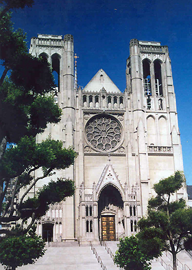 Across the
street from Huntington Park is Grace
Cathedral. This is the main
Episcopalian church in San Francisco. The original Grace Church, which
dates back to
the '49 Gold Rush, was destroyed in 1906 earthquake and fire. The new
cathedral is on the site of
another one of the demolished mansions (that of another of the "Big
Four" - Charles Crocker). The Crocker family gave their ruined Nob Hill
property for a diocesan cathedral. They started construction of the
cathedral in 1928 and finished it in 1964. The Episcopalian
cathedral is an almost exact replica of Notre Dame in Paris.
Across the
street from Huntington Park is Grace
Cathedral. This is the main
Episcopalian church in San Francisco. The original Grace Church, which
dates back to
the '49 Gold Rush, was destroyed in 1906 earthquake and fire. The new
cathedral is on the site of
another one of the demolished mansions (that of another of the "Big
Four" - Charles Crocker). The Crocker family gave their ruined Nob Hill
property for a diocesan cathedral. They started construction of the
cathedral in 1928 and finished it in 1964. The Episcopalian
cathedral is an almost exact replica of Notre Dame in Paris. 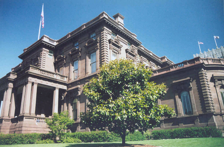 After
walking around the cathedral, we walked down California Street past the
Pacific-Union Club. This was
formally the mansion of Comstock millionaire James "Bonanza Jim" Flood
(1826-1888) who is also on the "The Wealthiest 100 Americans of All
Time" list. It was built in this prime location in 1886 for an
incredible (by even their time) $1.5 million dollars. It is the only
mansion to survive and the subsequent fire though the interior was
gutted by the fire) and is
often referred to as the Flood Mansion. It was designed by Willis Polk.
It is considered the first brownstone constructed west of the
Mississippi River. Along with the Fairmont Hotel across the street,
these were the only structures in the area to survive the San Francisco
earthquake and fire of 1906.
After
walking around the cathedral, we walked down California Street past the
Pacific-Union Club. This was
formally the mansion of Comstock millionaire James "Bonanza Jim" Flood
(1826-1888) who is also on the "The Wealthiest 100 Americans of All
Time" list. It was built in this prime location in 1886 for an
incredible (by even their time) $1.5 million dollars. It is the only
mansion to survive and the subsequent fire though the interior was
gutted by the fire) and is
often referred to as the Flood Mansion. It was designed by Willis Polk.
It is considered the first brownstone constructed west of the
Mississippi River. Along with the Fairmont Hotel across the street,
these were the only structures in the area to survive the San Francisco
earthquake and fire of 1906. 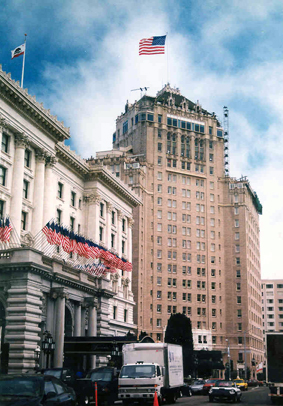 Across
the street from the mansion is the Fairmont Hotel on the corner of
Mason and California Streets (left in photo). The original
hotel was completed two days before the 1906 earthquake. Although the
outside structure survived, the interior was heavily damaged by fire
and opening was delayed until 1907. The new 591-room hotel was built
within the surviving facade and
opened a year later. The Fairmont hotel is located at the
only spot in San Francisco where each of the City's cable car lines
meet.
Across
the street from the mansion is the Fairmont Hotel on the corner of
Mason and California Streets (left in photo). The original
hotel was completed two days before the 1906 earthquake. Although the
outside structure survived, the interior was heavily damaged by fire
and opening was delayed until 1907. The new 591-room hotel was built
within the surviving facade and
opened a year later. The Fairmont hotel is located at the
only spot in San Francisco where each of the City's cable car lines
meet.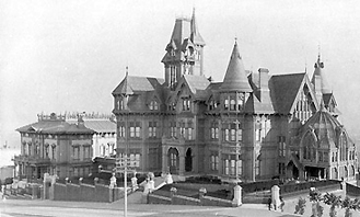 when it was de rigueur for
Pacific-bound servicemen to toast their goodbye to the States in the
"Top of the Mark" cocktail lounge.
when it was de rigueur for
Pacific-bound servicemen to toast their goodbye to the States in the
"Top of the Mark" cocktail lounge. We walked over to Powell Street
and strolled
around Union Square. Union
Square is a 2.6 acres, one city block square park bordered by Geary,
Powell, Post and Stockton Street. The name "Union Square" stems from
the fact that the area was once used for rallies and support for the
Union Army during the Civil War. The 1906 San Francisco earthquake
leveled most of the buildings that surrounded it. After our visit, it
was closed for a two-year renovation. Today, Union Square retains its
role as the ceremonial "heart" of San Francisco, serving as the site of
many public concerts, impromptu protests, speeches by visiting
dignitaries, and the annual Christmas tree and Menorah. Two cable car
lines (Powell-Hyde and Powell-Mason) serve the Union Square on Powell
Street.
We walked over to Powell Street
and strolled
around Union Square. Union
Square is a 2.6 acres, one city block square park bordered by Geary,
Powell, Post and Stockton Street. The name "Union Square" stems from
the fact that the area was once used for rallies and support for the
Union Army during the Civil War. The 1906 San Francisco earthquake
leveled most of the buildings that surrounded it. After our visit, it
was closed for a two-year renovation. Today, Union Square retains its
role as the ceremonial "heart" of San Francisco, serving as the site of
many public concerts, impromptu protests, speeches by visiting
dignitaries, and the annual Christmas tree and Menorah. Two cable car
lines (Powell-Hyde and Powell-Mason) serve the Union Square on Powell
Street.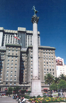 This is also
the center of one of San Francisco's more
exclusive shopping areas and the Theater District. Union Square has
become a popular shopping destination. It boasts six major department
stores: Macy's, Bloomingdale's, Barneys New York, Nordstrom, Saks Fifth
Avenue and Neiman Marcus. Union Square is also home to several famous
upscale boutiques like Louis Vuitton, Gucci, Dior, Chanel, Prada,
Giorgio Armani, Boucheron, Tiffany & Co., Piaget, Bulgari, Polo
Ralph Lauren, Lacoste, Marc Jacobs and Hermes.
This is also
the center of one of San Francisco's more
exclusive shopping areas and the Theater District. Union Square has
become a popular shopping destination. It boasts six major department
stores: Macy's, Bloomingdale's, Barneys New York, Nordstrom, Saks Fifth
Avenue and Neiman Marcus. Union Square is also home to several famous
upscale boutiques like Louis Vuitton, Gucci, Dior, Chanel, Prada,
Giorgio Armani, Boucheron, Tiffany & Co., Piaget, Bulgari, Polo
Ralph Lauren, Lacoste, Marc Jacobs and Hermes. An hour after midnight the fire reached Union
Square and
gutted the hotel. When the fire was finally put out three days later,
it was found that the St. Francis had suffered little serious damage.
The copper cornice had been warped, and some of the enameled facing
bricks had fallen off in the heat, but otherwise the building was
intact. Reconstruction began almost immediately and the hotel re-opened
in 1907. A third wing opened in 1908 and a 32-floor addition was opened
in 1972 on Post Street - making The St. Francis the largest hotel on
the Pacific Coast. Photo: Here we are
in Union Square with the St. Francis Hotel behind us - the old section
is on the left and the newer 1908 section is on the right.
An hour after midnight the fire reached Union
Square and
gutted the hotel. When the fire was finally put out three days later,
it was found that the St. Francis had suffered little serious damage.
The copper cornice had been warped, and some of the enameled facing
bricks had fallen off in the heat, but otherwise the building was
intact. Reconstruction began almost immediately and the hotel re-opened
in 1907. A third wing opened in 1908 and a 32-floor addition was opened
in 1972 on Post Street - making The St. Francis the largest hotel on
the Pacific Coast. Photo: Here we are
in Union Square with the St. Francis Hotel behind us - the old section
is on the left and the newer 1908 section is on the right. In 1921, the St. Francis was the scene of
Hollywood's first great scandal. Silent film comedian Roscoe Conkling
Arbuckle, also known as Fatty Arbuckle, was accused of assaulting and
raping a young actress, who later died, during a party at the St.
Francis. Arbuckle was later released when juries at three trials were
unable to reach a verdict but his career was ruined.
In 1921, the St. Francis was the scene of
Hollywood's first great scandal. Silent film comedian Roscoe Conkling
Arbuckle, also known as Fatty Arbuckle, was accused of assaulting and
raping a young actress, who later died, during a party at the St.
Francis. Arbuckle was later released when juries at three trials were
unable to reach a verdict but his career was ruined. called "lifting rooms." The most notable
feature of the
hotel was the Grand Court that served as an entry area for horse-drawn carriages. (This area was converted to a
palm filled public lounge a
few years before the 1906 earthquake). Presidents of the United States
Ulysses S. Grant, Benjamin Harrison and William McKinley visited the
Palace Hotel. King Kalākaua, the last reigning king of the Kingdom of
Hawaiʻi, died
at the old Palace Hotel in 1891.
called "lifting rooms." The most notable
feature of the
hotel was the Grand Court that served as an entry area for horse-drawn carriages. (This area was converted to a
palm filled public lounge a
few years before the 1906 earthquake). Presidents of the United States
Ulysses S. Grant, Benjamin Harrison and William McKinley visited the
Palace Hotel. King Kalākaua, the last reigning king of the Kingdom of
Hawaiʻi, died
at the old Palace Hotel in 1891. While the old Palace had a Hawaiin King die
while staying there, the new Palace would not be outdone. In 1923,
President Warren G. Harding and his wife were taking a tour of the
western states, especially Alaska, when Harding became ill. Staying in
a bed in a suite on the top floor of the Palace Hotel, Harding suffered
a heart attack and died on August 2, 1923 (rumors persisted that his
wife poisoned him because of his many infidelities, but there is no
proof of it).
While the old Palace had a Hawaiin King die
while staying there, the new Palace would not be outdone. In 1923,
President Warren G. Harding and his wife were taking a tour of the
western states, especially Alaska, when Harding became ill. Staying in
a bed in a suite on the top floor of the Palace Hotel, Harding suffered
a heart attack and died on August 2, 1923 (rumors persisted that his
wife poisoned him because of his many infidelities, but there is no
proof of it).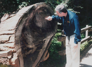 On one
of the days, we rented a
car to drive outside
San Francisco. We headed north across the Golden Gate Bridge. The toll
was $3 (though they have
since raised it to $5). We drove north to Muir
Woods National Monument
where we spent the morning. Muir Woods is the 554 acre home of the tallest type
of tree in
the world, the Coast Redwood (Sequoia sempervirens), a
relative of the Giant Sequoia.
On one
of the days, we rented a
car to drive outside
San Francisco. We headed north across the Golden Gate Bridge. The toll
was $3 (though they have
since raised it to $5). We drove north to Muir
Woods National Monument
where we spent the morning. Muir Woods is the 554 acre home of the tallest type
of tree in
the world, the Coast Redwood (Sequoia sempervirens), a
relative of the Giant Sequoia.
Here I am trying to count the rings - trust me, this one
was very old.
The Monument is an old-growth coastal redwood forest. Due to its proximity to the Pacific Ocean, the forest is regularly shrouded in coastal fogs, contributing to a wet environment that encourages vigorous plant growth. The fog is also vital for the growth of the redwoods as they use moisture from the fog during the dry summer. The Monument is cool and moist year round with average daytime temperatures between 40° and 70°. Rainfall is heavy during the winter and summers are almost completely dry with the exception of fog drip caused by the fog passing through the trees.
One hundred fifty million
years ago ancestors of redwood and sequoia trees grew throughout the
United States. Today, the Coast Redwood can be found only in a
narrow, cool coastal belt from Monterey to Oregon. Before the logging
industry came to California, there were an estimated two million acres
in this strip. However, by the early 20th century, most of these
forests had been cut down. Just north of the San Francisco Bay, one
valley named Sequoia Canyon remained uncut, mainly due to its relative
inaccessibility.
U.S. Congressman William Kent
his wife Elizabeth purchased 611 acres with
the goal of protecting the redwoods and the mountain above them. In
1907, the Kents donated much of it to the U.S. Government. On January
9,
1908, President Theodore Roosevelt declared the land a national
monument and it was named after naturalist John Muir, whose
environmental campaigns helped to establish the national park system.
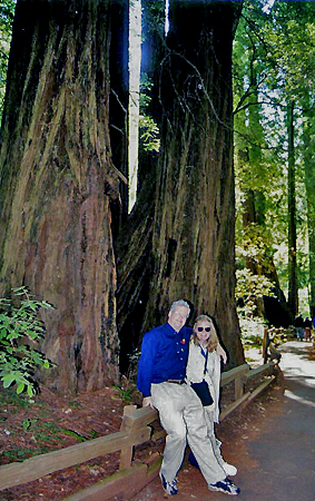 |
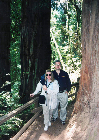 |
Here we are
standing among the Redwoods (photo above left). While redwoods can grow
to nearly 380 ft., the
tallest tree in the Muir Woods is 258 ft. tall.
The average age of the redwoods in the Monument are between 500 and 800
years old with the oldest being at least 1,100 years old. We
hiked along one of the trails called "Hillside Trail" (Trail Map). It took us about
a hour and a half to complete the trail. We went to the gift shop
afterwards and bought a small redwood bark that when watered would grow
a small redwood plant. We noticed that throughout the park, where
redwoods had fallen, small trees started growing out of the trunks of
the fallen trees. After leaving Muir Woods, we continued to drive north
on Route 1.
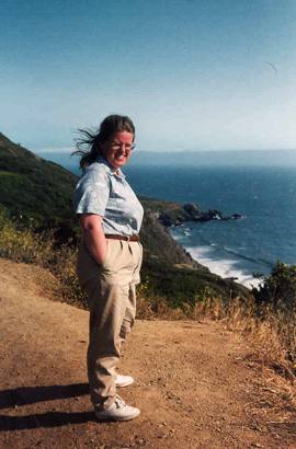 Route 1 is a
very interesting road.
There are places that you are driving along a cliff that drops into the
ocean with not even a guardrail between your car and the edge. It does
make you very aware of your driving ability. Especially when cars are
coming in the opposite direction. There were some great look-out areas
where you can park and get a great view of the Pacific Ocean. I took a
picture of Debbie at one (the view is to the southwest). As you can see
it was sunny and warm - that was about to change.
Route 1 is a
very interesting road.
There are places that you are driving along a cliff that drops into the
ocean with not even a guardrail between your car and the edge. It does
make you very aware of your driving ability. Especially when cars are
coming in the opposite direction. There were some great look-out areas
where you can park and get a great view of the Pacific Ocean. I took a
picture of Debbie at one (the view is to the southwest). As you can see
it was sunny and warm - that was about to change.
We stopped in a small town for
lunch
and then continued up the coast. The weather turned worse as fog rolled
in. We stopped at the town of Bodega Bay which is about 40
miles northwest of San Francisco.
Bodega Bay was discovered in
1775 by the Spanish explorer Juan Francisco de la Bodega y Quadra,
after whom it is named. He planned to return, but never did. In
1812, the Russian-American Company established Fort Ross about 15 miles up the coast
and began growing grain and shipping it to Alaska from Bodega Bay. The
Bay remained an active harbor for shipping lumber until the 1870s, when
the North Pacific Coast Railroad was built, bypassing the coast in
favor of a more inland route.
 We stopped
in a park
next to
the ocean. It was very windy and cold. Good thing we had our jackets
on, after all, it was July (photo at right). Look at that idiot tourist
standing out on
that rock in the Pacific Ocean. Later we drove into the town and
stopped at the Tides Restaurant. Bodega Bay
became famous when Alfred Hitchcock featured the town in his 1963
movie, The Birds (this
website gives still pictures from the movie). The Tides
Restaurant was featured in the movie, but has expanded a lot since
1963. We did not see the schoolhouse
used in the movie, which still stands in Bodega Bay. We
kept a good lookout, but the birds did
not bother us.
We stopped
in a park
next to
the ocean. It was very windy and cold. Good thing we had our jackets
on, after all, it was July (photo at right). Look at that idiot tourist
standing out on
that rock in the Pacific Ocean. Later we drove into the town and
stopped at the Tides Restaurant. Bodega Bay
became famous when Alfred Hitchcock featured the town in his 1963
movie, The Birds (this
website gives still pictures from the movie). The Tides
Restaurant was featured in the movie, but has expanded a lot since
1963. We did not see the schoolhouse
used in the movie, which still stands in Bodega Bay. We
kept a good lookout, but the birds did
not bother us.
 Eating in San
Francisco is one of the best things about visiting here. The hardest
part is choosing one. Without a
doubt, our favorite place was a restaurant called the Stinking Rose on
Columbus Avenue (pictured at left) in the North Beach section. We had
to wait about an hour, but it is well worth it. It is a garlic
restaurant that is totally devoted to the smelly herb. We liked it so
much, we came here twice. The place has marble table tops, terra-cotta
walls with strings of garlic draped throughout the place.
Eating in San
Francisco is one of the best things about visiting here. The hardest
part is choosing one. Without a
doubt, our favorite place was a restaurant called the Stinking Rose on
Columbus Avenue (pictured at left) in the North Beach section. We had
to wait about an hour, but it is well worth it. It is a garlic
restaurant that is totally devoted to the smelly herb. We liked it so
much, we came here twice. The place has marble table tops, terra-cotta
walls with strings of garlic draped throughout the place.
As an
appetizer, they have garlic cloves, oven-roasted in extra virgin olive oil and butter,
called Bagna Calda, that you can spread on fresh Italian rolls. They
serve it in a small iron skillet over a candle (you can see it on our
table). This you must have. All of their meals have garlic included in
some way shape or form. One night, I tried the 40-clove prime rib and
the other night the Italian garlic meatloaf. Debbie had their pasta
dishes. For desert, I tried the garlic ice cream with
caramel sauce. It
was interesting. I may never order it again, but at least I can say I
tried it once. They also have garlic wine, but we were not that brave.
For those who do not like garlic, they have what is called 'vampire
fare' - meals made without garlic (what else). They do have an ample
supply of
breath freshners at the counter when you leave.
 Of
course, we enjoyed lunch at
any
number of places on Fisherman's Wharf that serves clam chowder in a
sourdough bread bowl (picture at right) like at the
Boudin
Sourdough Bakery.
Of
course, we enjoyed lunch at
any
number of places on Fisherman's Wharf that serves clam chowder in a
sourdough bread bowl (picture at right) like at the
Boudin
Sourdough Bakery.
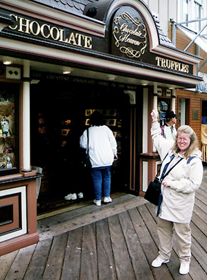 Another place
that we went to was John's Grill
on Ellis Street in the Financial District. The crime writer Dashiell
Hammett made this restaurant famous when he used it as a setting in his
1930's book, The Maltese Falcon.
His hero Sam Spade (Humphrey Bogart in the movie version) used to eat
lunch here. The restaurant is not featured in the movie. It has
dark paneled walls and booths. It serves mostly steaks and seafood. I
had a prime rib while Debbie tried some of their seafood. The food,
along with the atmosphere, made it a very pleasurable night.
Another place
that we went to was John's Grill
on Ellis Street in the Financial District. The crime writer Dashiell
Hammett made this restaurant famous when he used it as a setting in his
1930's book, The Maltese Falcon.
His hero Sam Spade (Humphrey Bogart in the movie version) used to eat
lunch here. The restaurant is not featured in the movie. It has
dark paneled walls and booths. It serves mostly steaks and seafood. I
had a prime rib while Debbie tried some of their seafood. The food,
along with the atmosphere, made it a very pleasurable night.
We also went to a fantastic Italian
restaurant called Il
Fornaio on Battery Street. They are famous for their baked
bread.
We also went to the Rainforest Cafe. I know it's not a San Francisco
highlight, but I just like their interiors.
Needless to say, certain stores attracted Debbie's attention. Of course, anyplace that sold chocolate for one. Here is a store on Pier 39 in Fisherman's Wharf that had a magnetic pull that she felt.

